A Fifth Anniversary Vacation for Abby and Richard


Driving from home in Ada to Farmington, New Mexico
My wife Abby and I find that this drive, which we have made many times both alone and together, is never boring. Among other things, it represents the path to adventure. The road itself is mostly interstate highway, one of the most traveled of all the routes connecting the wild west with the rest of America, Interstate 40. Over the years, we have learned the route well, including most of its photo opportunities: the red quonset hut, the leaning water tower, the giant cross, Cuervo, the “plague town,” Tucumcari Mountain, and on and on.
By the time we arrived in Farmington, after some 14 hours on the road, sleep came easy.

Farmington to Moab, Utah
There are several routes into southeastern Utah, and on this occasion, we decidedto let the GPS suggest our route.
It took us through Four Corners, then up the Aneth highway, which is a neat little piece of scenery, then to Blanding, where we always stop at their clean, interesting visitor’s center. We usually buy maps there, and sometimes they have gift bags for us.

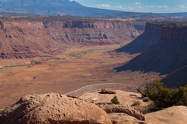
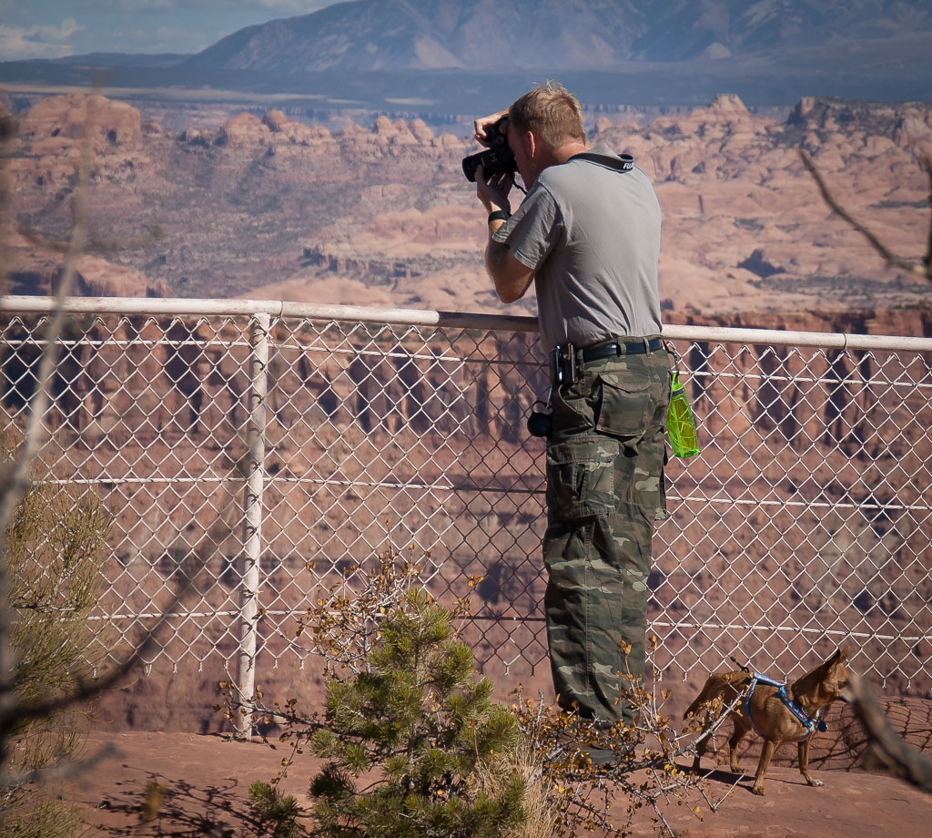
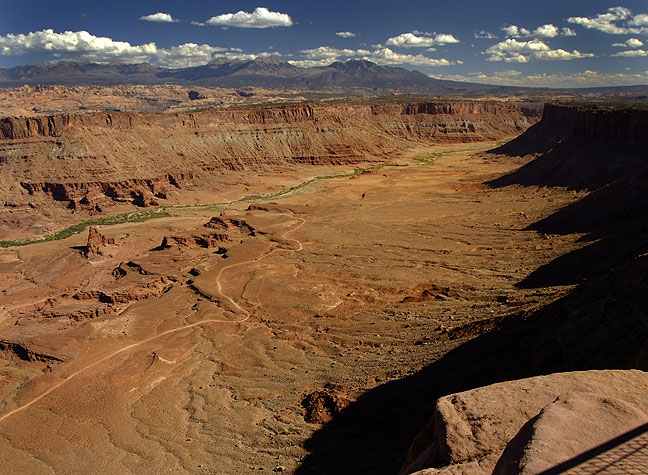
By midday we were at Hatch Point, which we like because it sports excellent overlooks, and we can hike a little with the Chihuahuas, Max and Sierra. Crews were working on the unpaved portion of the road, and had taken down the sign to the Canyonlands Overlook, which we took anyway, only to find that it had washed out. We continued on to the Anticline Overlook, where we hiked around the short trail with the dogs.


By late afternoon, we were in Moab, and settled in to our motel for the night.

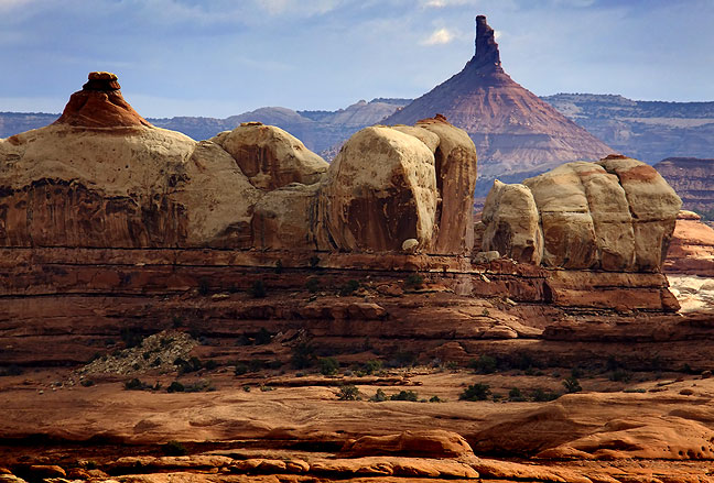
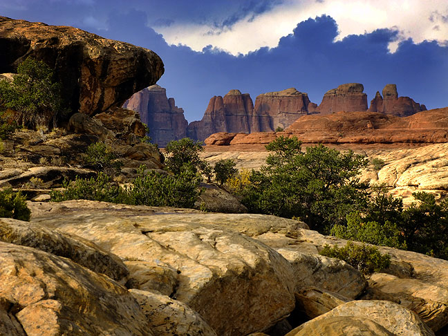
The Needles District and a Thunderstorm at Canyonlands National Park
With rain in the forecast, I got a before-daybreak start. I drove south to the Needles District at Canyonlands, where I thought I could hike from the Elephant Hill access road to Chesler Park, then turn north and make the Devil’s Kitchen/Devil’s Pocket loop. It is the only trail in the Chesler Park area that can be day-hiked that I haven’t seen. The weather looked foreboding, so instead I struck out south from the Squaw Flat campground, to the bench at Wooden Shoe Butte. I felt that I could see some of the heart of The Needles, do a little exploring, and still be close enough to the trail head that if rain came and stayed, I wouldn’t be out in it for too long. Once I got to the butte, I broke from the trail and explored to the west though an exceptionally beautiful section of slickrock benches and buttes.
I could see dark clouds to the west and hear thunder, so I navigated back to the trail and headed back to the trail head. About a mile from cover, rain, with embedded hail, started, but was tolerable, and didn’t last long. It ended up being an easy hike.


As I drove out on the main road, the rain began to pour, and at one point lightning struck about 300 yards from the car. A little farther down the road, I stopped several times to attempt to photograph the amazing cottonwoods along Indian Creek.


Hidden Valley and Delicate Arch
Abby felt like sleeping in with the dogs in the morning, so I headed a few miles south of Moab to a trail I had seen on the map for years, but never tried, the Hidden Valley trail. Almost immediately from the trail head, short, rocky switchbacks lead up the 680 feet that from the Spanish Valley appears to be a wall of rocks. Near the top is an inlet that opens into a wide, flat valley. The trail follows it another two miles northwest in the Behind the Rocks Wilderness Area to Petro Pass, where it joins the Moab Rim Jeep trail. I was fortunate to have a chilly breeze and clear, blue skies. I turned around at the pass and headed home.


By late morning, Abby was up and feeling like a hike, and when we are in Moab, we like to hike to Delicate Arch in Arches National Park, where we got married in 2004.


We left the dogs in the room (since they are not allowed on National Parks trails), and made the hike. It was breezy and cool, the sky was a perfect pearl blue like the day we got married, and it was simply great to have Abby with me on “our” trail. Her knees were bothering her, so we took it slow, but that didn’t matter.


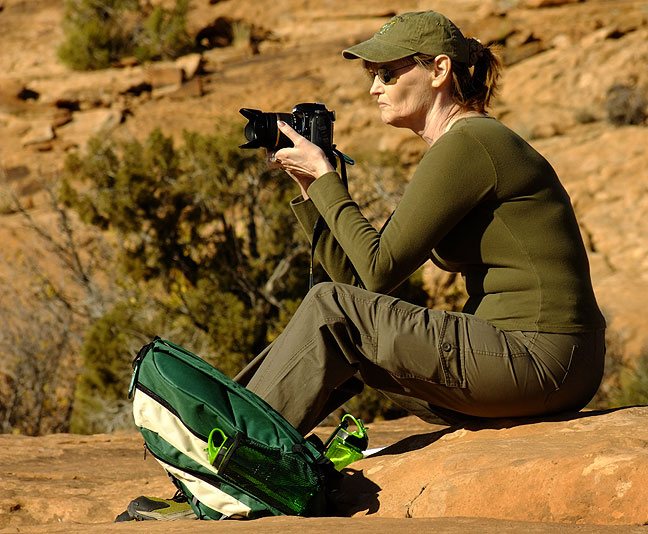
At Delicate Arch I observed something new: no one was posing under the arch. In the past, particularly in the evening, the “photographers” and the “tourists” can get into arguments about who has the right to do what there. The photographers think they are making some important images (and of course think that they themselves are important), while the tourists just want to have fun. This time, however, was oddly different. There were more photographers than I have ever seen at the arch (in six visits), and most of them had tripods. Most of the cameras were very expensive digital Nikons and Canons. All but a few had set up on the approach to the arch, the ridge to the north one encounters as you first see the arch. Oddly, this spot yields the most predictable image, almost a “mug shot” of this Entrada sandstone miracle. I have this shot; I make it every time I visit, since it’s so easy. But all these people were all making this same photo. Odd.

In the midst of all this, Abby and I relaxed and enjoyed the afternoon. We didn’t come to make amazing photos. We came to celebrate five years of happy marriage after our wedding at this amazing place.


A nice German couple asked if we would take a picture of them with their camera, and they did the same for us.
The hike down was fun, too, and we both were tremendously happy to be there together.


Sand Flats and Hunter Canyon
For our last day in Moab, we wanted to explore a few spots that we’d never seen, and where we could take the dogs.
Our first venue was the legendary Sand Flats Recreation Area, a world-renowned Jeep and mountain bike paradise just east of Moab on the Porcupine Ridge. We drove around and saw dozens of tricked-out Jeeps, some dirt bikes, some ATVs (in southeastern Utah they are abbreviated OHVs), and of course lots of mountain bikes. We hiked for a mile or so down a Jeep road, letting the dogs play and taking a few pictures. We were passed by several dirt bikes, and a couple who had two West Highland Terriers.


Later in the morning, we drove to Hunter Canyon, a deep and impressive formation in the midst of dozens of towering sandstone canyons. With the dogs in tow, Abby and I hiked some of the way down the canyon, far enough to see and photograph Hunter Arch.


Finally, we drove the Kane Creek road to the intersection with the Chicken Corners road, and photographed an odd formation called the “Devil’s Golf Ball.” It was also neat to see the Anticline Overlook from the spot it over looks.


On the Road Again: Moab to Tucumcari, then Home
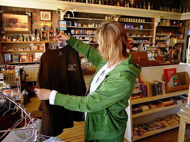
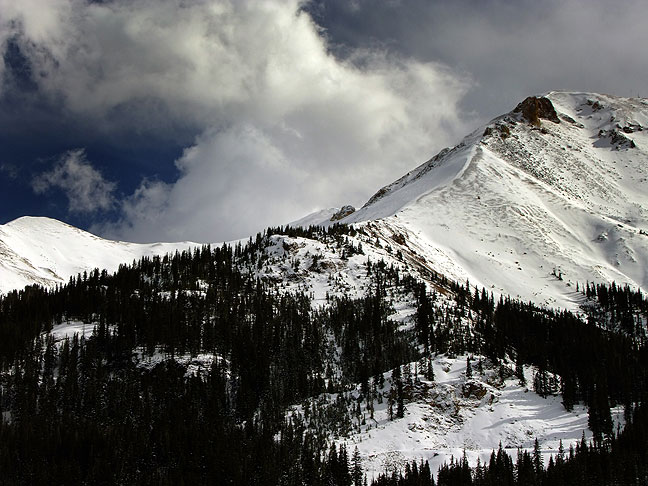
Abby and I decided to take a longer route home than usual, since we had the whole weekend for travel. From Moab, we turned immediately east at La Sal Junction, crossing into Colorado near the Paradox Valley. We stopped at a charming general store in Bedrock, Colorado, then made our way through the Dallas Divide, Ouray, Red Mountain Pass, Silverton, and Durango before joining our more familiar route south into New Mexico. The mountain scenery and high country snows were inspirational.

This trip was our first in our new Nissan Rogue, and Abby and I were both very pleased with its qualities. It got excellent fuel mileage, had plenty of space for us, our stuff, and our dogs, and was comfortable over the many hours on the road. There were several occasions when the all-wheel drive was a factor, and several more where its excellent ground clearance took it places my Grand Am could never have gone.
Our dogs travel well and are little trouble. They seem to enjoy being with us no matter what, and take in the trail like they were born to do it.
Abby and I had an excellent fifth anniversary vacation.


I find these images beautifully succinct and compositionally precise.
Thank you.