From the Country to the Deep Country

Pontotoc County Emergency Management Director Chad Letellier works at the Emergency Operations Center at the Pontotoc County Agri-Plex recently.
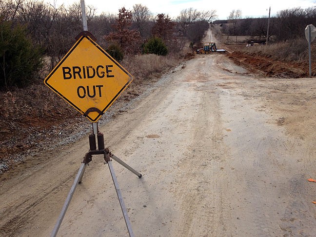
Approaching this bridge revealed that the signs and Chad's advice were right: the bridge was out, but we could all get across using what Chad described as a "shoo fly," which was a dirt round down and around the bridge.
Approaching this bridge revealed that the signs and Chad’s advice were right: the bridge was out, but we could all get across using what Chad described as a “shoo fly,” which was a dirt round down and around the bridge.

Yesterday we heard a bunch of frantic calls from firefighters working on a large grass fire northwest of nearby Roff, Oklahoma. I headed that way, expecting to see a smoke plume to which I could navigate, but by the time I got down there, the fire was mostly contained. I called Pontotoc County Emergency Management Director Chad Letellier to get a location and he told me it was near the intersection of county roads 3445 and 1610, “Except that the bridge is out on 1610, but you can take a little shoo fly around it.”

As I got close, I started hearing chatter on the fireground frequency, 154.355Mhz, which is a simplex (car-to-car) channel, so I knew I was getting close. At the scene, I turned onto a two-track farm trail and flipped on the all-wheel drive.

Area firefighters make their way through a pasture after working to extinguish a wildfire estimated to cover about 50 acres in the vicnity of County Roads 1610 and 3445 northwest of Roff Wednesday, Jan. 28, 2015.
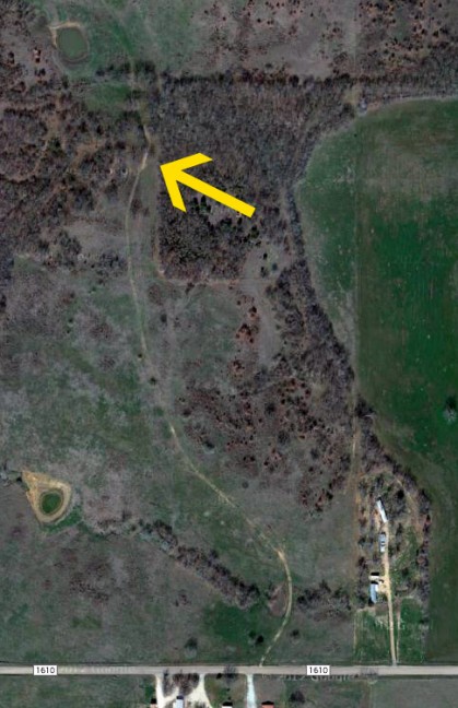
The yellow arrow shows where I parked my car to make the image below. The nearest town, Roff, population 500, is about six miles southeast of this location.

As I approached a creek, I saw some of the brush trucks coming out, so I pulled over and got out to make a few images. On the frequency I heard, “That’s The Ada News. Who got their pictures taken?” I smiled at that.

I drove deeper onto the ranch, then parked and walked another 200 yards or so to a wooded area that was still smoldering.

I think of myself as living in the country, which I do compared to the suburbs or a city, since Abby and I live on a seven-acre patch in a town where we can burn brush and shoot our guns. But then I go on these assignments, and see what it must be like to really live in the country.

This is my Nissan Juke parked near a creek bed where I made images of yesterday's wildfire.
This is my Nissan Juke parked near a creek bed where I made images of yesterday’s wildfire.

Speaking of the small town web, here is another fun one: the Ada Cougar cheerleaders wore t-shirts to a wrestling match recently, and on the shirts was the picture I shot of them in May…

The Ada High cheerleaders yell for their wrestlers last week. That night they wore t-shirts with my photo of them.

Leave a Reply

Your email address will not be published. Required fields are marked *